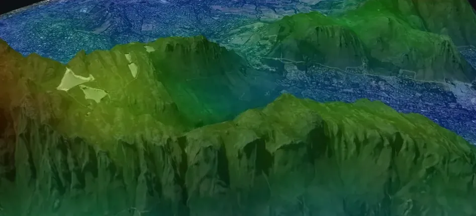
Digital Elevation Models
Ultra-High Resolution
Elevation Models
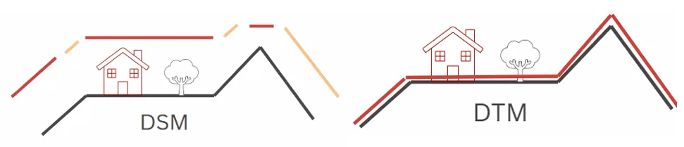
South Africa's first homogeneous national elevation dataset - 25cm resolution imagery covering 1.2 million km², processed into 1m DSMs and 2–5m DTMs with AI-driven bare-earth classification.
DSM vs DTM - What's the Difference?
Two complementary elevation products derived from the same 25cm source imagery, each serving a distinct analytical purpose.
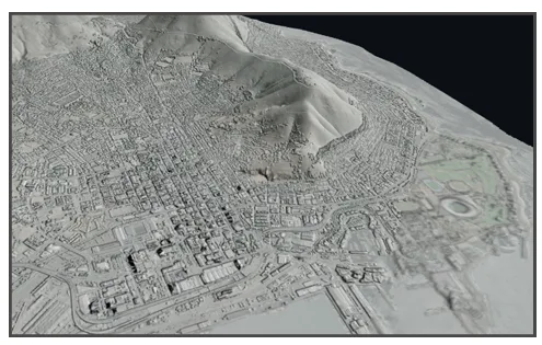
Digital Surface Model
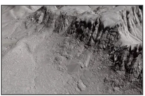
Digital Terrain Model
Photogrammetry vs LiDAR
Two primary methods for generating high-precision terrain models - each with distinct strengths and trade-offs at national scale.
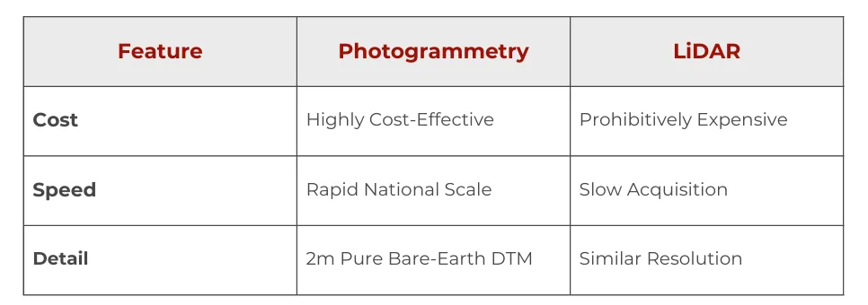
Cost-effective at national scale
- Rapid acquisition for national coverage
- Full-colour imagery alongside elevation
- 2m pure bare-earth DTM accuracy
Precise, but prohibitively expensive nationally
- Superior bare-earth penetration in dense forest
- Multiple return pulses for vegetation stratification
- Slower, costlier acquisition at national scale
Built on the elevation models
The DSM and DTM are the foundation. From them Riskscape derives the products engineers, planners and insurers actually work with.
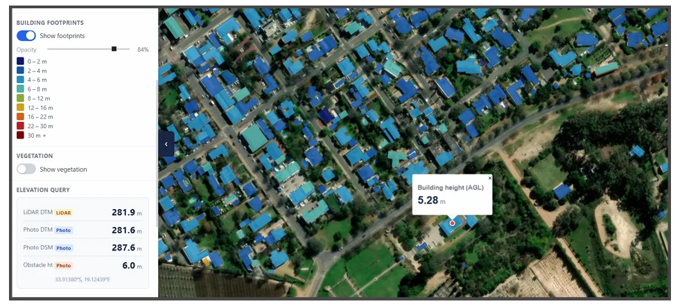
3D Building Footprints
Riskscape uses the DSM to detect height changes and isolates individual building outlines with height attributes. Simple 2D footprints become accurate 3D structural models - enabling precise volume, roof area and replacement cost calculations.
Used for
- Insurance risk assessment - roof area, building volume and footprint for replacement cost and underwriting.
- Urban densification - floor area ratios, shadow analysis and zoning compliance for municipal spatial teams.
- Energy & solar feasibility - building volume and orientation for consumption modelling and rooftop solar potential.
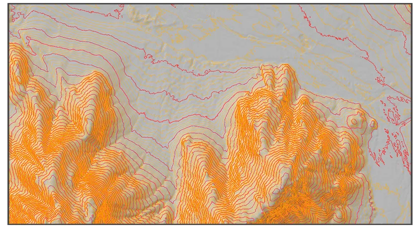
Contour Lines
Contour lines connect points of equal elevation, turning the complex DTM surface into a readable map for engineers, planners and field professionals. Configurable at any interval from the national dataset.
Used for
- Civil engineering - site levelling, cut-fill calculations and earthworks volume planning.
- Agriculture - irrigation layout, water flow direction and soil erosion management.
- Construction - site drainage design, foundation planning and road alignment.
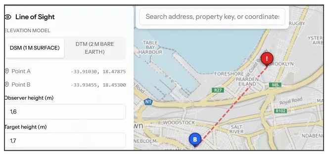
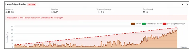
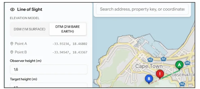
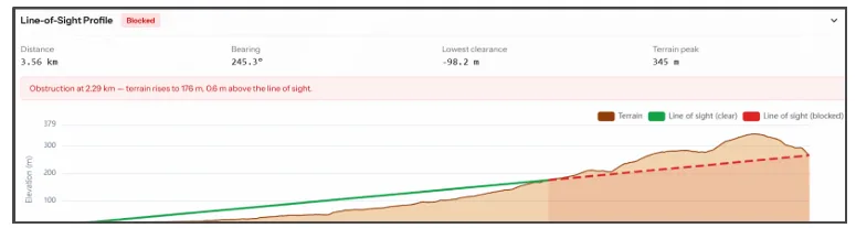
Line-of-Sight Analysis
A geometric analysis that determines whether one point can see another without obstruction - computed across both DSM and DTM to show surface and terrain obstructions separately.
Used for
- Telecommunications - 5G tower placement for rural and urban connectivity.
- Security & defence - surveillance coverage mapping and blind-spot identification.
- Real estate - unobstructed views for valuation and development approvals.
Why the Combination is Essential
By integrating DTM, DSM, 3D footprints, contours and line-of-sight, Riskscape provides a complete digital twin of South Africa's built and natural environment.
Risk Modelling
Urban Development
The partnership behind the data
GeoSpace International
Hexagon
Riskscape
Who Uses Riskscape Elevation Data
Insurance & Banking
Telecommunications
Infrastructure
Environment
Riskscape 3D Building Model - Live Demo
Scroll to play
Access South Africa's national elevation dataset
Sign up on Console to order and download elevation tiles straight away.